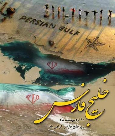
The Islamic Republic of Iran designated April 30th as the "national day of Persian Gulf" and has also issued a series of stamps commemorating the “The national day of Persian Gulf".
The Islamic Republic of Iran designated April 30th as the "national day of Persian Gulf" and has also issued a series of stamps commemorating the “The national day of Persian Gulf".
The Persian Gulf (Persian: خلیج فارس, translit. Xalij-e Fârs, lit. 'Gulf of Fars') is a mediterranean sea in Western Asia. The body of water is an extension of the Indian Ocean (Gulf of Oman) through the Strait of Hormuz and lies between Iran to the northeast and the Arabian Peninsula to the southwest. The Shatt al-Arab river delta forms the northwest shoreline.
The Persian Gulf was a battlefield of the 1980–1988 Iran–Iraq War, in which each side attacked the other's oil tankers. It is the namesake of the 1991 Gulf War, the largely air- and land-based conflict that followed Iraq's invasion of Kuwait.
The gulf has many fishing grounds, extensive coral reefs, and abundant pearl oysters, but its ecology has been damaged by industrialization and oil spills.
The body of water is historically and internationally known as the "Persian Gulf". Some Arab governments refer to it as the "Arabian Gulf" or "The Gulf", but neither term is recognized internationally. The name "Gulf of Iran (Persian Gulf)" is used by the International Hydrographic Organization.
The Persian Gulf is geologically very young, having been formed around 15,000 years ago
Geography
This inland sea of some 251,000 square kilometres (96,912 sq mi) is connected to the Gulf of Oman in the east by the Strait of Hormuz; and its western end is marked by the major river delta of the Shatt al-Arab, which carries the waters of the Euphrates and the Tigris. Its length is 989 kilometres (615 miles), with Iran covering most of the northern coast and Saudi Arabia most of the southern coast. The Persian Gulf is about 56 km (35 mi) wide at its narrowest, in the Strait of Hormuz. The waters are overall very shallow, with a maximum depth of 90 metres (295 feet) and an average depth of 50 metres (164 feet).
Countries with a coastline on the Persian Gulf are (clockwise, from the north): Iran; Oman's exclave Musandam; the United Arab Emirates; Saudi Arabia (in Iran this is called "Arvand Rood", where "Rood" means "river"); Qatar, on a peninsula off the Saudi coast; Bahrain, on an island; Kuwait; and Iraq in the northwest. Various small islands also lie within the Persian Gulf, some of which are the subject of territorial disputes between the states of the region.
Extent
The International Hydrographic Organization defines the Persian Gulf's southern limit as "The Northwestern limit of Gulf of Oman". This limit is defined as "A line joining Ràs Limah (25°57'N) on the coast of Arabia and Ràs al Kuh (25°48'N) on the coast of Iran (Persia)".
Name
In 550 BC, the Achaemenid Empire established the first ancient empire in Persis (Pars, or modern Fars), in the southwestern region of the Iranian plateau. Consequently, in the Greek sources, the body of water that bordered this province came to be known as the "Persian Gulf".During the years 550 to 330 BC, coinciding with the sovereignty of the Achaemenid Persian Empire over the Middle East area, especially the whole part of the Persian Gulf and some parts of the Arabian Peninsula, the name of "Pars Sea" is widely found in the compiled written texts.
In the travel account of Pythagoras, several chapters are related to description of his travels accompanied by the Achaemenid king Darius the Great, to Susa and Persepolis, and the area is described. From among the writings of others in the same period, there is the inscription and engraving of Darius the Great, installed at junction of waters of Red Sea and the Nile river and the Rome river (current Mediterranean) which belongs to the 5th century BC where Darius the Great has named the Persian Gulf Water Channel: "Pars Sea" ("Persian Sea").
Considering the historical background of the name Persian Gulf, Sir Arnold Wilson mentions in a book published in 1928 that "no water channel has been so significant as Persian Gulf to the geologists, archaeologists, geographers, merchants, politicians, excursionists, and scholars whether in past or in present. This water channel which separates the Iran Plateau from the Arabia Plate, has enjoyed an Iranian Identity since at least 2200 years ago." Before being given its present name, the Persian Gulf was called many different names. The classical Greek writers, like Herodotus, called it "the Red Sea". In Babylonian texts, it was known as "the sea above Akkad".
Islands
The Persian Gulf is home to many small islands. Bahrain, an island in the Persian Gulf, is itself a Persian Gulf Arab state. Geographically the biggest island in the Persian Gulf is Qeshm island located in the Strait of Hormuz and belonging to Iran. Other significant islands in the Persian Gulf include Greater Tunb, Lesser Tunb and Kish administered by Iran.
International documents
There is some evidence that the Persian Gulf was the old name of the Persian Gulf and other documents that the three islands of the Greater Tunb and the Lesser Tunb and Abu Musa is that Iran is before the UAE was formed.