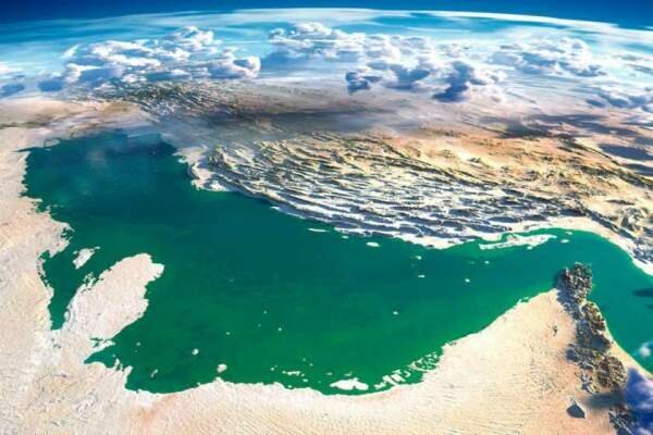
Tenth of the second Iranian calendar month Ordibehesht (April 29) marks the National Persian Gulf Day, which is the anniversary of the victory over Portuguese troops during a war in the Persian Gulf in 1622.
The occasion commemorates the exit of colonial and foreign forces from the strategic waterway.
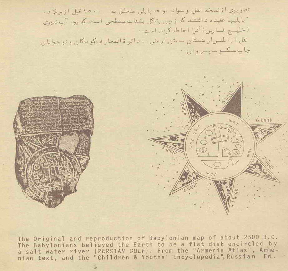
The Persian Gulf and its equivalent in different languages has been used continuously since 2,500 years ago in all languages and all over the world, especially in the Arab world.
Geography, as the most ancient human knowledge, is an applied science that has different aspects. It studies the reciprocal relation of man and nature and provides the results to the users in the form of documents in writing, books, and maps.
The name of a feature cannot be observed on the land like the feature itself. Thus, by mentioning the case on maps, Atlases, and books, it will be protected during different eras as a part of historical, cultural identity and saved as human’s heritage.

For the same reason, any change, destruction, or alteration of the names registered in historical deeds and maps is like the destruction of ancient works and is considered as an improper action.
The Persian Gulf is located in the southwest of the Asian Continent on the south side of the vast country of Iran, with a length of 1,259 kilometers.
During all the centuries, and at least during the past 2,500 years, i.e. as of the time of the powerful Pars Empire there has never been seen such a unanimity in the West Asia among writers and historians on one name during history, according to the Persian Gulf Studies Center.
Persian Gulf in historical documents
No written deed has remained since the era before the Pars Empire, but in the oral history and culture, the Iranians have called the southern waters: Jam Sea, Iran Sea, Pars Sea.
In the travel account of Pythagoras, several chapters are related to description of his travels accompanied by Darioush, a king of Achaemenid, to Shoush and Perspolis, and the area is described.
From among the other significant deeds written in this field, the world map: Hecataeus (472 to 509 B.C.) can be stated where Persian Gulf has been clearly shown.
At the same time, many maps and deeds prepared up to the 8th century by the scientists and geographical researchers such as Hecataeus and Herodotus (father of Science of Geography) and in the Islamic period, Mohammad Ibn Mousa Kharazmi, Abou Yousef Eshagh Kandi, Ibn Khardazabeh, Harrani (Batani), and others, mention that there is a wide sea at south of Iran named Pars Sea, Pars Gulf, Fars Sea, Fars Gulf, Bahre Fars, Sinus Persicus and Mare Persicum and so on.
By describing the water body, the life of Persians living at both sides have also been confirmed.
Persian Gulf in historical maps
In all the important historical maps and Atlas whether modern or belonging to previous centuries, the water artery located at south of Iran has been registered as Persian Gulf. In the Arabian countries too, it has always been named Persian Gulf up to the 70s.
For instance, in the Atlas "Alaragh fi Alkhavaret Alghadimeh" by Dr. Ahmad Souseh (Baghdad 1959) including 40 maps among the Arabian sources of the Middle Ages. In the maps presented by Arabian countries to the International Court of the Judiciary for settlements of border claims, the name of Persian Gulf has been mentioned.
The book: "Osoul Alkuwait Almanshour Alalam" (1991) published in the Netherlands also contains 15 maps where the name of Persian Gulf exists.
In Atlas of "History of Islam" (1951-55 America and Egypt) the name Persian Gulf has been mentioned 16 times.
Furthermore, about 30 valid Atlas have registered the name of Persian Gulf within the past 30 years, such as Atlas of Thomas Herbert (1628), Atlas of Pars, Lousaj University (1863), Atlas of Germany (1861), Pars Envile Atlas (1760), Atlas of Modern Geography (1890), Atlas of London (1873), Atlas of Ernest Embrosius (1922), Atlas of Bilefild (1899), and Atlas of Harmsorth (19th Century, London).
Application of Persian Gulf by international organizations
Organizations and affiliated foundations have applied the correct name of Persian Gulf since they have been incorporated, excluding one case, which corrected it through Note No.6 AD311/1GEN dated March 5, 1971.
In confirmation and response to the correspondence of the government of Iran for application of the complete name of Persian Gulf in the publications and deeds of United Nations and affiliated organizations, 14 notes and correspondences can be mentioned containing the aforementioned note of Secretariat of United Nations, containing the amendment of Deed IPPD14/UNIDB.
In all the above-mentioned notes and circulars, it has been requested that the water body existing on the south side of Iran be stated: Persian Gulf. The Specialized Group for Experts on Standardization of Geographical Names, active in the United Nations Social Economical Council also emphasizes the correct use of historical names for features and is active in dispute settlement related to geographical names.
Source: Tehran Times

Add new comment